
Marketing is all about engaging the viewer. The vast majority of what we encounter on line is simply viewed, read or heard. We read posts, look at photos, watch videos and listen to recordings.
But there are always applications emerging that can engage us by allowing us to interact with what we see. We do more than just look or listen, we take action by zooming and panning and clicking. This engages our motor functions and stimulates our brains.
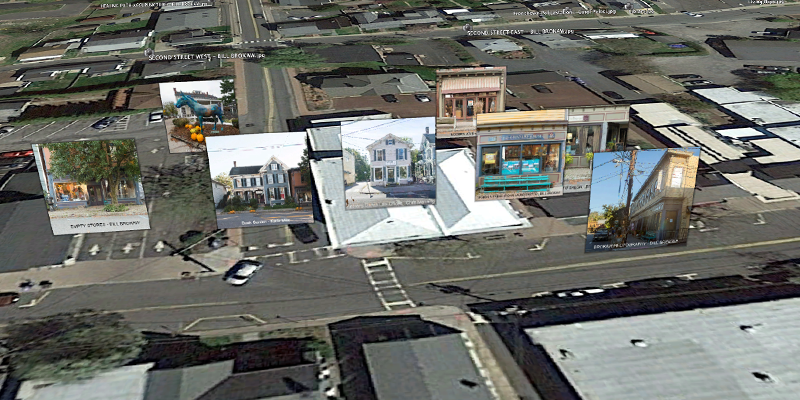
One of my favorite applications is Google Earth which lets me fly around the globe, zoom in on areas and check out photos. Naturally, I want to put my own content out there so I launched a project called Frenchtown 150 to commemorate Frenchtown NJ’s 150th anniversary.
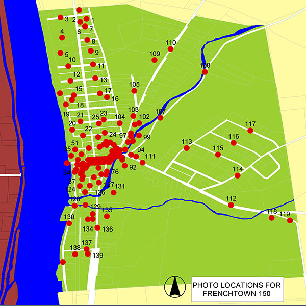
My vision was to generate 150 photos of 150 locations in the borough and put them on Google Earth where viewers could pan and zoom around to explore both visually and spatially. I recruited a small group of about 20 other talented photographers from my Meetup Group (Frenchtown Photography Meetup ) and assigned them locations to shoot and instructed them on how to post-process and georeference their images. Below is a GIS generated map of the locations for the photographers.
Upon receive the image files I utilized a tool written by programmer, Timothy Whitehead, who works for Red Wing Aerobatx and lives in Cape Town, South Africa. Timothy’s tool allowed me to batch create a KML file with the georeferenced images with I then modified to enable hyperlinking to the image files on my website. Upon launching the KML file, the photo locations and image files become visible on Google Earth.
Each camera icon below represents a photo which can be viewed upon zooming in or by clicking on the menu of locations to the left of the aerial photo.
![]()
The fun part is flying around viewing the photos. Below is a little screen recording showing the images and how they float above their respective locations. The program is coded to only show the images when zoomed or when they are in the center of the screen. As one pans and zooms around the various photos become visible. You can access the project through this link – http://businessphotos.us/FRENCHTOWN150/
For more information on how to launch such a project for your locations contact me: Bill@BrokawPhoto.com