logo

Tag : Google Earth

30 Nov 2017

LEVERAGING GOOGLE MAP AND GOOGLE EARTH

Locations matter when having events. People need to know where you are.

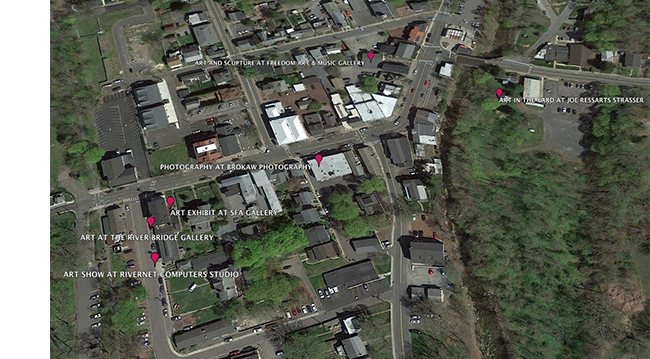
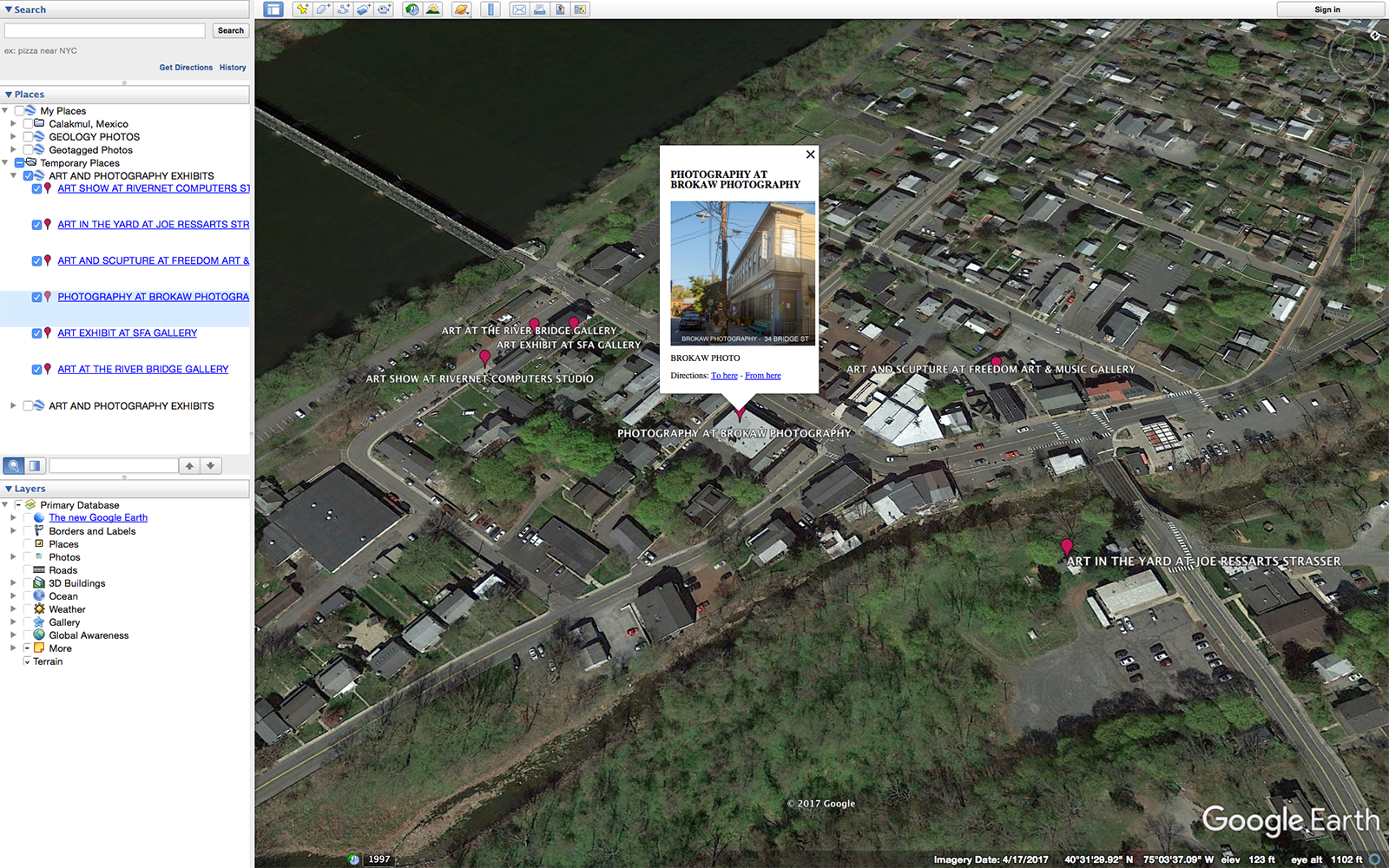
Brokaw Photography Studio and five art galleries are having group shows in Frenchtown this weekend.  We’ve all posted our events on Facebook but when we do that we simply create six separate silos of information.  To bring us all together and to inform visitors of our locations I thought it would be great to create a live Google Maps and to locate all the galleries on Google Earth.

The beauty of Google Maps is it is entirely scalable and universal.  Anyone with a browser can find us around town and determine where we are in relation to themselves.  If you have a Google account you can plot locations, label them, add photos and share the link.  Here is the link to my map: http://bit.ly/2irqDBi

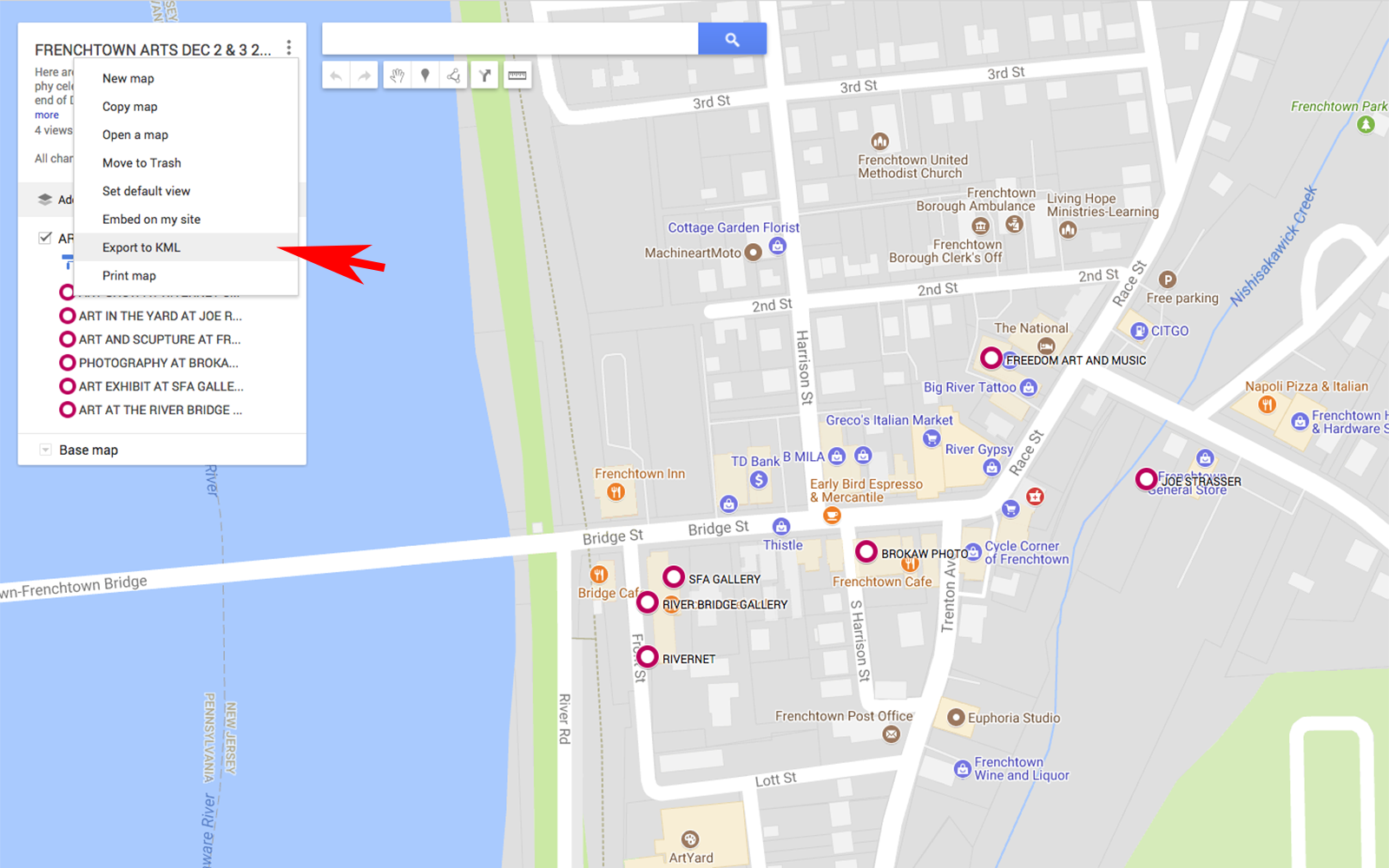
After the map has been created Google Maps enables a user to convert the locations along with any attached photos to a KML file, a simple a text file with information that can be read by mapping applications such as Google Maps and Google Earth.

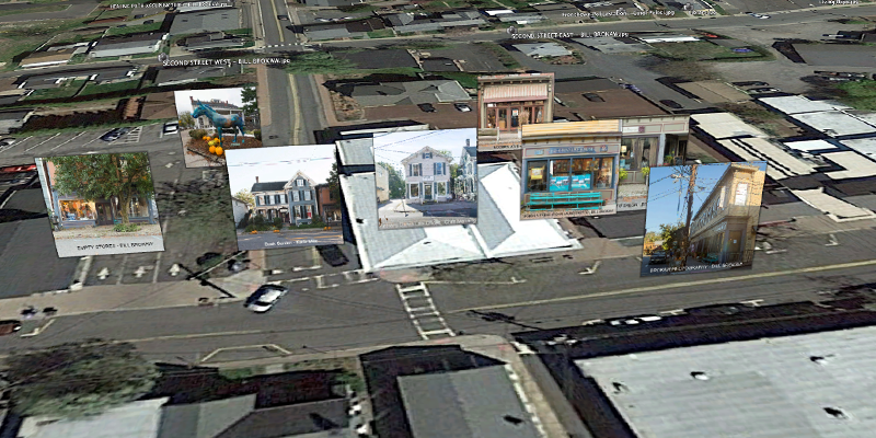
With Google Earth, the locations, along with attached information such as photos, can be accurately displayed on an aerial photo that can be rotated, zoomed and panned.  The screenshot below shows a SW oblique angle of the town, the show locations and one of the pop-ups that are available to see the attached information that was created in Google Maps.

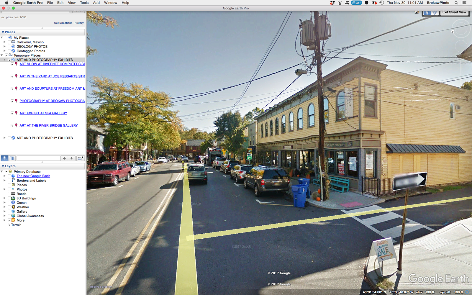
Google Earth puts Google Maps into a three dimensional rendering draped over a sphere.  When you zoom in all the way, it drops you into Street View which is a 360 degree spherical  view from street level.


It is always fun and useful to add an interactive application to information.  When people engage and play with your content they remember it better…

31 Oct 2017
FRENCHTOWN BUSINESSES ON GOOGLE EARTH

LEVERAGING GOOGLE EARTH

Marketing is all about engaging the viewer.  The vast majority of what we encounter on line is simply viewed, read or heard. We read posts, look at photos, watch videos and listen to recordings.

But there are always applications emerging that can engage us by allowing us to interact with what we see.  We do more than just look or listen, we take action by zooming and panning and clicking.  This engages our motor functions and stimulates our brains.

One of my favorite applications is Google Earth which lets me fly around the globe, zoom in on areas and check out photos.  Naturally, I want to put my own content out there so I launched a project called Frenchtown 150 to commemorate Frenchtown NJ’s 150th anniversary.

My vision was to generate 150 photos of 150 locations in the borough and put them on Google Earth where viewers could pan and zoom around to explore both visually and spatially.  I recruited a small group of about 20 other talented photographers from my Meetup Group (Frenchtown Photography Meetup ) and assigned them locations to shoot and instructed them on how to post-process and georeference their images. Below is a GIS generated map of the locations for the photographers.

Upon receive the image files I utilized a tool written by programmer, Timothy Whitehead, who works for Red Wing Aerobatx and lives in Cape Town, South Africa.  Timothy’s tool allowed me to batch create a KML file with the georeferenced images with I then modified to enable hyperlinking to the image files on my website.  Upon launching the KML file, the photo locations and image files become visible on Google Earth.

Each camera icon below represents a photo which can be viewed upon zooming in or by clicking on the menu of locations to the left of the aerial photo.…