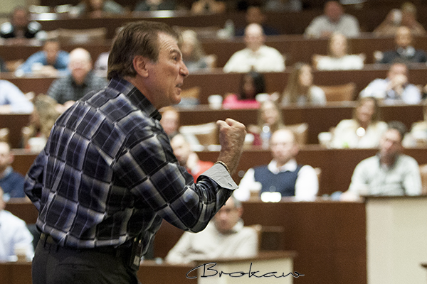
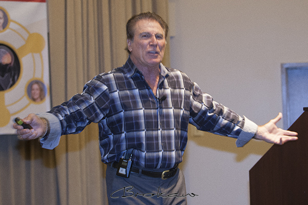
Vince Papale “walked on” to the Philadelphia Eagles in the 1970s and made history. An unknown 30 year old guy from the neighborhood who never played football decided to try out and became an NFL legend. Disney even made a movie about him called Invincible.
Vince’s football days are behind him and now he travels the country giving talks and motivating everyone from corporate executives to high school athletes.
Vince’s story is impressive, for sure, but as I photographed him during a recent event, it was obvious to me that it all boils down to passion. Passion is that driving energy available to all of us. It’s when desire for an outcome obliterates all doubt and resistance. As Vince so clearly describes and demonstrates, passion doesn’t just happen. You cultivate it.
Be passionate.


…
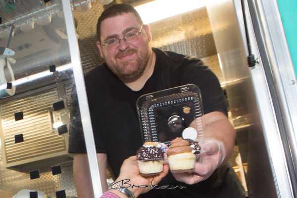
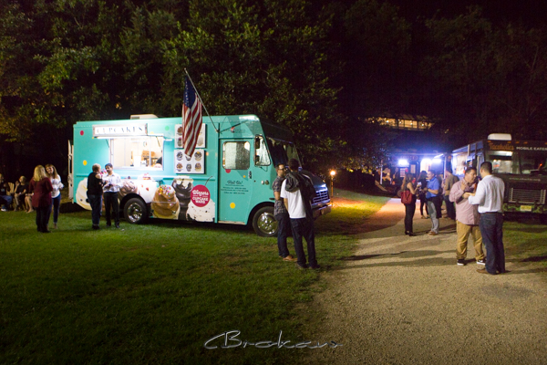
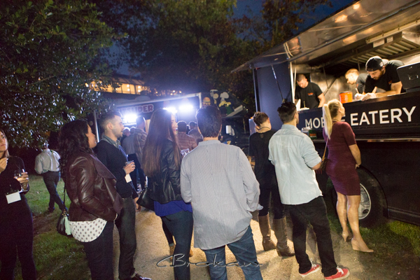
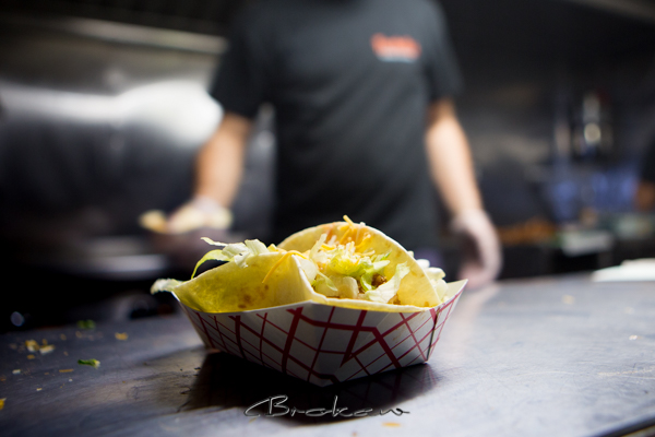
Like many companies, Promius Pharma annually convenes its people from around the country to bring them together as a team and enhance their focus on the company mission. And of course the first night is a time for settling in and getting off to a good start with a social event. This year Promius met at the Crown Plaza in Princeton and decided it would be fun to have food trucks cater the party.
I’ve photographed a lot of corporate events and this one was a blast. What a great idea. It was relaxed, fun and ever so tasty!

…
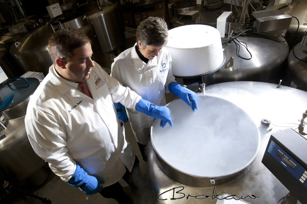
Really cold brew at BioStorage, part of a facility at Rutgers University where they keep stuff on ice (not beer, though).
I’ve photographed a number of sites specializing in cryogenic storage and it’s pretty amazing to see how technology enables us to seriously cool things down and essentially stop the aging process.
Funny, though, when it gets really cold, I certainly don’t feel my aging process slowing down.
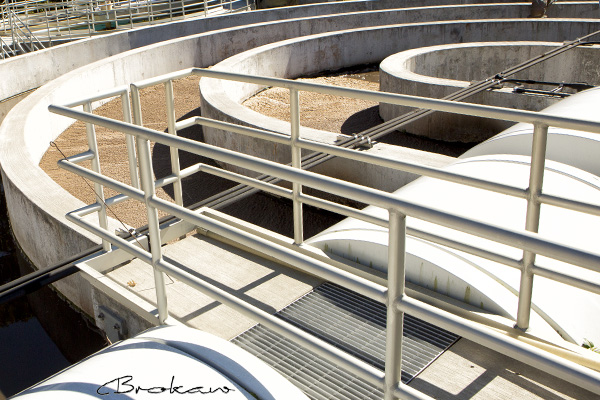
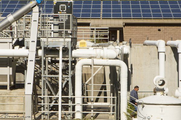
I don’t often think of the visual graphic appeal of sewage treatment plants.
Actually, I don’t really think of sewage treatment very often, but recently, when on assignment photographing this facility I couldn’t help but notice its visual elegance.
Everything at a treatment plant is designed for a purpose and within this design is a kind of graphic beauty.
I always enjoy photographing engineered structures. Especially when the light is awesome. Ideally, it works as well as it looks.
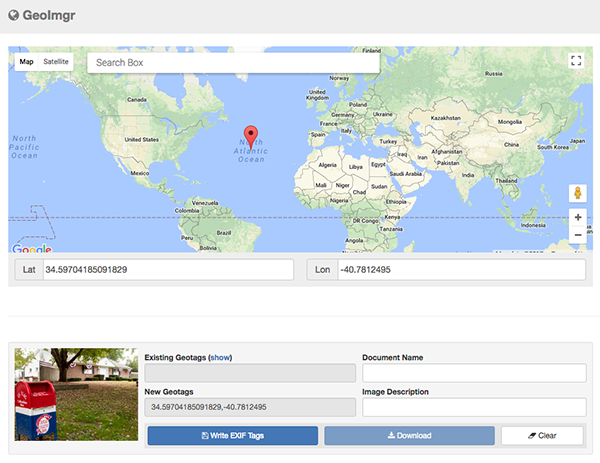
Geotagging is fairly easy and is required in order to embed a photo on Google Earth. Geotagging is the process of adding latitude/longitude coordinates to the metadata of a photo.
Some cameras will geotag automatically when you take a photo. However, this is the location of the camera when the photo was taken, not the the location being photographed. For our project, FRENCHTOWN 150, we are adding custom coordinates to our digital files. This can be done a number of ways including Lightroom (see my post PROCESSING AND GEOTAGGING FOR FRENCHTOWN 150 IN LIGHTROOM).
You can also geotag online.
Before uploading your photo to geotag it you need to:
CROP YOUR PHOTO SQUARE
RESIZE IT TO 1200×1200 pixels
LABEL “LOCATION – PHOTOGRAPHER.”
NAME IT “LOCATION – PHOTOGRAPHER.jpg”
When your photo is properly cropped, sized, labelled and named, upload it to geoimgr.com to geotag it.
The site is fairly intuitive. Here is a short video of the steps.
…
“Digital Basics” Oct 21st 9:00 AM – 12:00 PM ($69)
This workshop is for those getting starting in the world of digital photography.
We will cover the basic concepts of the digital technology, camera settings and guidelines on how to create better photos. The course is taught at a nice, even step by step pace, covering topics thoroughly but without technical jargon.
Call or email to register: 908-996-4440 Bill@BrokawPhoto.com
TOPICS
About your camera:
Learn a little about just what a digital camera is and how it works. We will cover basic camera functions, menus and lenses
What is a digital image:
This topic will give you a basic understanding of just what you are creating when you take a photo. We’ll discuss pixels, resolution and image quality.
Photographing:
How do we get good, well exposed photo that are in focus? We will examine the core principles for what make great photos such a landscapes, portraits, sports and candids.
LOCATION
Brokaw Photography Studio
34 Bridge Street
Frenchtown NJ
908-996-4440
MAP…
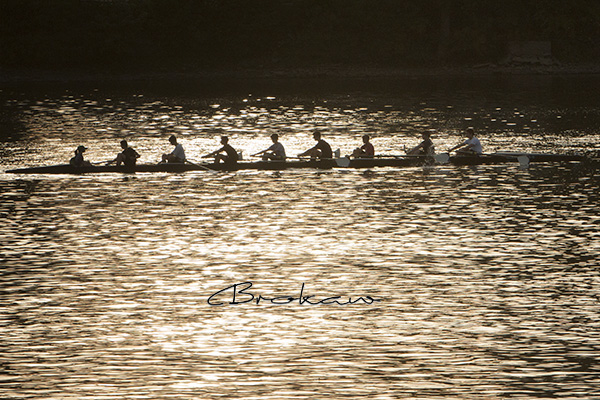
It’s often harder than it looks to coordinate teams, even when everyone is doing the same thing. Watching a novice crew team row up the river is fun. It’s not an entirely graceful thing to see, but entertaining.
The crew wants to do the right thing. The coxie sees what needs to be done and everyone strives to coordinate.
We all have teams of one kind or another. Some are long lasting, others are fleeting but they all share a common denominator, we are all in it together.…
These are the steps for processing your photos in Lightroom. See “GEOTAGGING ONLINE” post if you do not use Lightroom.
You need to:
CROP YOUR PHOTO SQUARE
GEOTAG IT
NAME IT “LOCATION – PHOTOGRAPHER.jpg”
RESIZE IT TO 1200×1200 pixels
LABEL “LOCATION – PHOTOGRAPHER.”
SUBMIT IT
The video at the bottom of this post illustrates the steps itemized below.
- Import the best, most representative photo of your location into Lightroom and then select it to make it active.
- Switch to the “DEVELOP” mode to enhance your image and to crop it.
- Select the crop tool and using the “Aspect Ratio” pulldown menu, crop your photo 1×1 ratio. You made have to hit the little lock icon to unlock your photo and allow the square cropping.
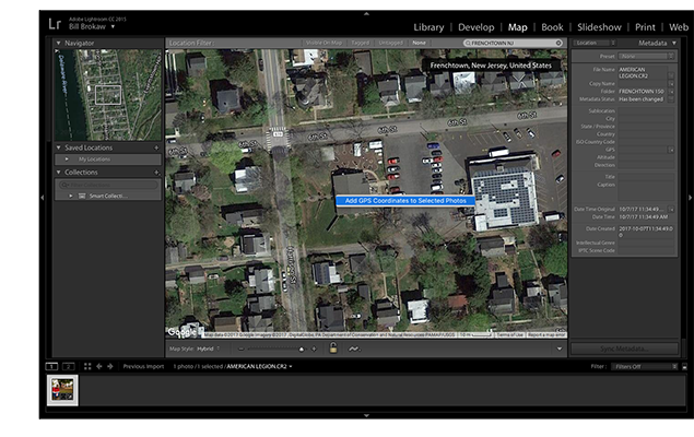
- With your photo still selected, switch to the “MAP” mode and search for Frenchtown NJ.
- Zoom and pan the map until you find the location you photographed. When you find your location, right click on the map to get the coordinates (latitude/longitude).
PLEASE NOTE! You want to get the coordinates of the location you photographed, not the location where you were standing when you took the photo. (If your camera has GPS it may have already assigned coordinates your your file which must be over-written because these would be the coordinates of the camera rather than the coordinates of the location photographed.) - After assigning coordinates, switch to the “LIBRARY” mode and click the Export button.[Steps 7 through 9, below (File Naming, Sizing and Labeling) can also be done outside of Lightroom using other software tools.]
- Use the File Naming function to name your file “LOCATION – PHOTOGRAPHER.” (Note this can also be done after exporting using any file naming function on your computer.)
- Use the Image Sizing function to make your file 1200 pixels x 1200 pixels @ 200 dpi.
Frenchtown 150 is underway. This collaborative photo project is a comprehensive visual and on-line spatial representation of Frenchtown, NJ.
Here is a link to maps showing the photo locations. Click to view (if this link does not work for you I can email you the maps):
FRENCHTOWN 150 PHOTO LOCATIONS
The list of locations and photographers assigned to these location is below. Email me directly to select a location and get on the list.
Participating photographers select specific locations to photograph throughout the borough. The photos should be documentary in nature. They should be clear, crisp, well-composed and visually representative of the locations being photographed. The photos will be cropped square as part of the processing and this should be taken into account when composing the photo.
Upon completing the photography, photographers will crop, size, label and geotag their photos (only one photo of each location) and then submit their files via email.
Check out this post for a tutorial on processing and geotagging your photos in Lightroom.
PROCESSING AND GEOTAGGING FOR FRENCHTOWN 150 IN LIGHTROOM
You can also geotag your photos online.
GEOTAGGING ONLINE
When all the location have been photographed and the files properly processed, they will be published on Google Earth.
The objective of the project is to illustrate Frenchtown as it is in October 2017 and to use current Internet technology to enjoy the results.
Below is the list of the locations, their map ID numbers and the photographers who have selected the locations to photograph. This list will be updated by me as more photographers select locations to photograph.
Everybody is somewhere. (Whether we know where we are is another question.) For many businesses, it is all about location, location, location. Where you are matters.
When it comes to commercial photography, the images produce often are created to show the feel and character of a business’s location. This also is true for business communities, like Frenchtown, NJ, that rely on visitors.
Digital photography allows us to tag our files with latitude/longitude coordinates and on-line tools, such as Google Earth can read these coordinates and position the images in their exact location on a map.
So as an experiment (and to push the spatial envelope) I launched my latest project called Frenchtown 150. I am coordinating a group of photographers to create a comprehensive visual and on-line spatial representation of Frenchtown to celebrate its 150th year anniversary and show just what it is like, now, in October 2017.
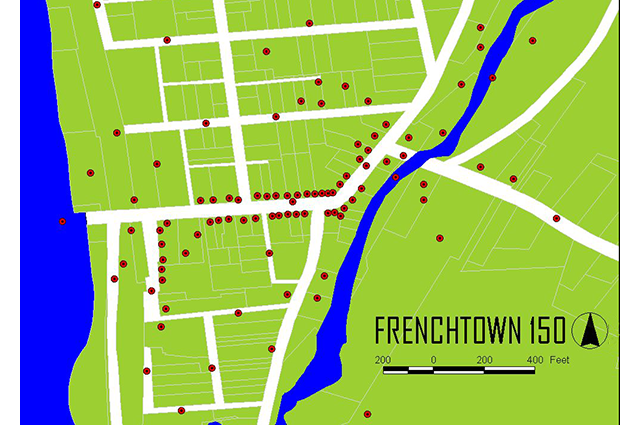
The first step was to generate a properly scaled map of all the proposed photo locations using GIS software (ArcView) as shown above. 150 locations were plotted ranging from forest trails to downtown businesses.
Step two will be to corral the photographers, instruct them on the project parameters, and then have them shoot the photos and tag them with coordinates.
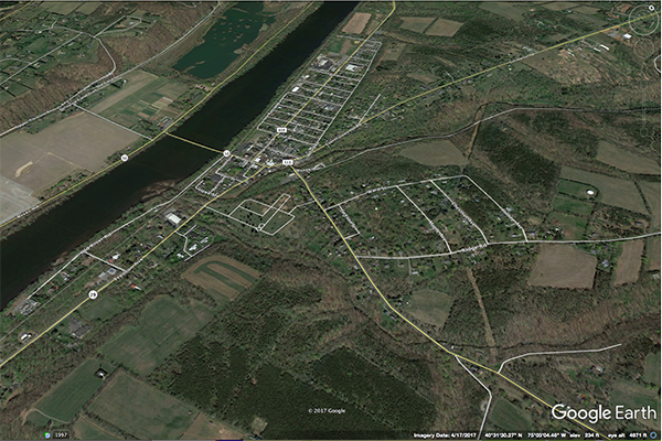
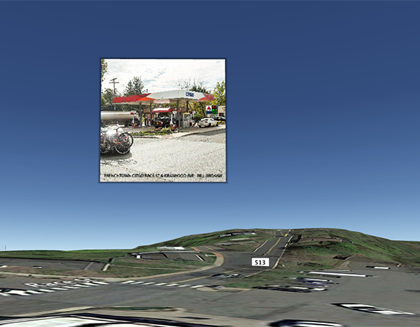
The final step will be to compiled all the geotagged images on Google Earth which will enable users to fly in and view the photos on a three dimensional map of the Earth. The photo below is an actual screen shot of Google Earth showing one of the embedded business photos floating above it’s actual location.
I can see this being applicable for many businesses, whether a single location or multi locations. We’ve got the tools out there. Let’s use them.

