The Hunterdon Places Photo Project shoot, April 21 and 22nd, has resulted in a wonderful body of work by the 90 participating photographers. Each of them embraced the spirit of the project, went out and captured images and collectively submitted 384 photos. These photos show us who we are, here, in Hunterdon County, now, in early 2018.
Pretty cool!
One photograph from each photographer was selected to be part of the print exhibitions on May 26-27 at Brokaw Photography (12:00-5:00 PM) in Frenchtown and again on June 2 at the Hunterdon Community Day Celebrations (12:00-4:00 PM) at the County Fairgrounds in Ringoes. All the photos that were submitted will also be displayed in an on-line gallery for all to see.
Here are the results of the shoot.
PHOTOS SUBMITTED PER PHOTOGRAPHER
| PHOTOGRAPHER | PHOTOS SUBMITTTED |
| Adam Berger | 7 |
| Adolfo Kohara | 3 |
| Aileen Britt | 1 |
| Aja Wallace | 9 |
| Alan Schultz | 2 |
| Alan Stultz | 5 |
| Alex White | 12 |
| Amanda Green | 9 |
| Amy Lenhardt | 5 |
| Annie Fantini | 9 |
| Barbara Wingel | 1 |
| Barry McMickle | 9 |
| Bill Brokaw | 5 |
| Bill Claus | 3 |
| Bob Opacki | 2 |
| Brenda Quinn | 5 |
| Brendan Noonan | 3 |
| Brian Jones | 1 |
| Cheryl Bomba | 1 |
| Cheryl Jackson | 1 |
| Chris Larson | 7 |
| Chris Manning | 10 |
| Claire Jones | 6 |
| Connor Williams | 6 |
| Daniel Stoops | 8 |
| Dave Durand | 3 |
| Dave Kovacs | 7 |
| David Fisher | 4 |
| David Lennard | 8 |
| David Voros | 4 |
| David Wiant | 7 |
| Diane Webster-Sweeney | 4 |
| Dusty Nelson | 1 |
| Elaine Ciba | 5 |
| Ellen Rosen | 2 |
| Erik Renninger | 2 |
| Evelyn Wenrich | 2 |
| Gail Hare | 5 |
| Gerry Hare | 6 |
| Haeree Park | 1 |
| Ian McLaughlin | 1 |
| J MacManis | 5 |
| Jack Brown | 6 |
| Jade Cihanowyz | 4 |
| Jaimee Gold | 2 |
| James Verhalen | 1 |
| Jamie Gregson | 4 |
| Jo Lenhardt | 1 |
| Joey Italia | 2 |
| John Lenhardt | 4 |
| June Filipski | 5 |
| Kathleen Gorman | 1 |
| Kathy Bieger Roche | 1 |
| Keith Bobrowski | 1 |
| Laura Case | 1 |
| Laura Orbine | 5 |
| Laura Rainville | 4 |
| Linda Aller | 2 |
| Linda Cerny | 10 |
| Lori Van Pelt | 3 |
| Lou Nunez | 3 |
| Madeline Dowe | 4 |
| Maria Naccarato | 3 |
| Melissa Mertzman | 2 |
| Mike Brint | 13 |
| Mitch Speert | 3 |
| Nadia Jaworskyj | 1 |
| Nick Zelinsky | 10 |
| Nicolas Baptista | 3 |
| Nina Rusecky | 1 |
| Olivia Forte | 1 |
| Pam Hirst | 2 |
| Pat Abbott | 1 |
| Regina Mushrock | 2 |
| Rhonda Pagano | 12 |
| Rob Creteau | 10 |
| Ron Torsky | 4 |
| Rus Smith | 1 |
| Sam Robinson | 9 |
| Samantha Wenrich | 4 |
| Sarah Evangelista | 10 |
| Sean Castellano | 1 |
| Skyler Esposito | 4 |
| Sophia Kosty | 2 |
| Steven Buller | 6 |
| SueAnn Rainey | 1 |
| Tamela Gorman | 4 |
| Thom Horvath | 2 |
| Tiffany Simone | 4 |
| Tracie Steinmetz | 5 |
| William OBrien | 2 |
| TOTAL PHOTOS | 384 |
PHOTOS SUBMITTED PER TOWN
| TOWN | PHOTOS SUBMITTED |
| Bloomsbury | 21 |
| Califon | 29 |
| Clinton | 37 |
| Flemington | 36 |
| Frenchtown | 35 |
| Glen Gardner | 34 |
| Hampton | 32 |
| High Bridge | 48 |
| Lambertville | 34 |
| Lebanon | 22 |
| Milford | 27 |
| Stockton | 29 |
| TOTAL PHOTOS | 384 |
PHOTOS TO BE EXHIBITED PER TOWN
| TOWN | EXHIBITION PHOTOS |
| Bloomsbury | 5 |
| Califon | 8 |
| Clinton | 12 |
| Flemington | 10 |
| Frenchtown | 6 |
| Glen Gardner | 3 |
| Hampton | 7 |
| High Bridge | 10 |
| Lambertville | 15 |
| Lebanon | 4 |
| Milford | 6 |
| Stockton | 4 |
| TOTAL PHOTOS | 90 |
…
Compressing a file will reduce the file size while keeping the dimensions and resolution the same.
To compress a photo file size in Photoshop you can use the Export function which will create a new smaller file without changing the original
From the dropdown menu choose: File -> Export -> Export As…
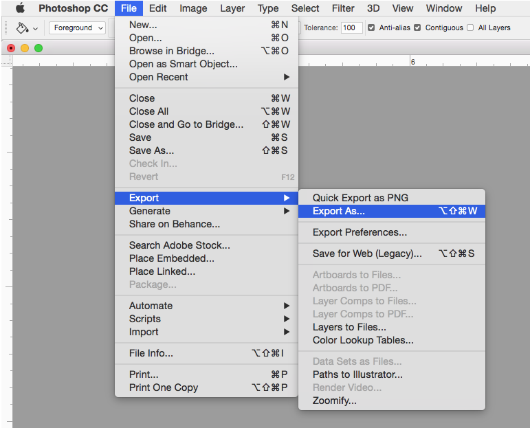
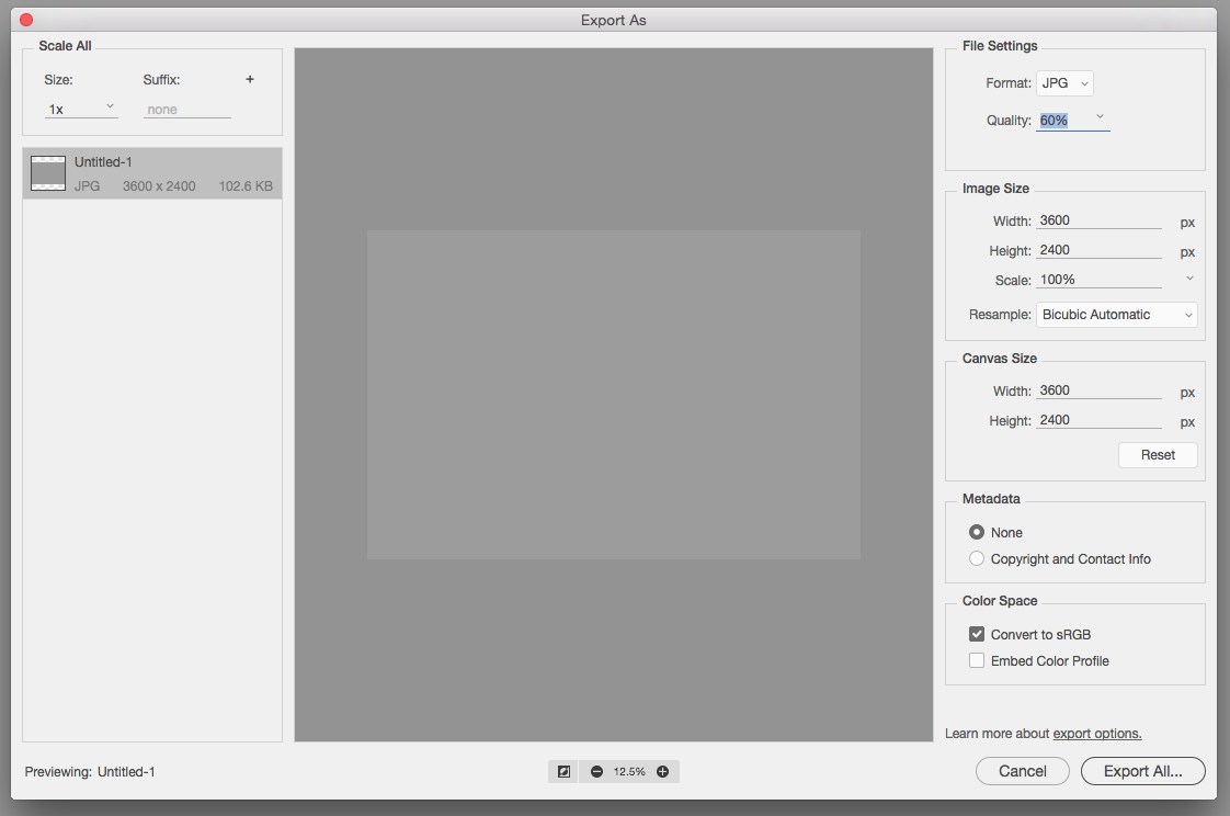
The “Export As…” function will bring up the dialog box as shown below. Under File Settings lower the quality percentage as much as you need to reach the file size you want. Under Image Size and Canvas Size specify the size of the output image. Click Export All and save it as new file in a different folder or using a different name to prevent Photoshop from overwriting your original.
 …
…
This post provides a simple 5-step method for adding coordinates to your photos using Adobe Lightroom. Adding coordinates is called geotagging and creates a permanent record of where you took your photo and allows the photo to be added to Google Earth and other mapping applications.
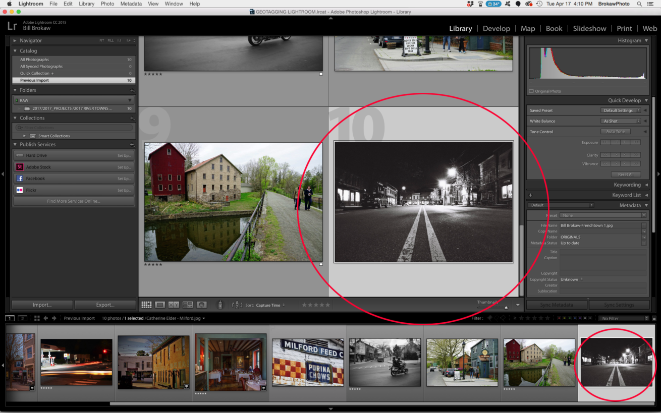
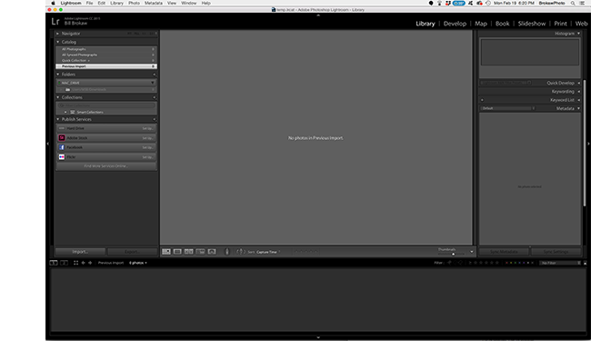
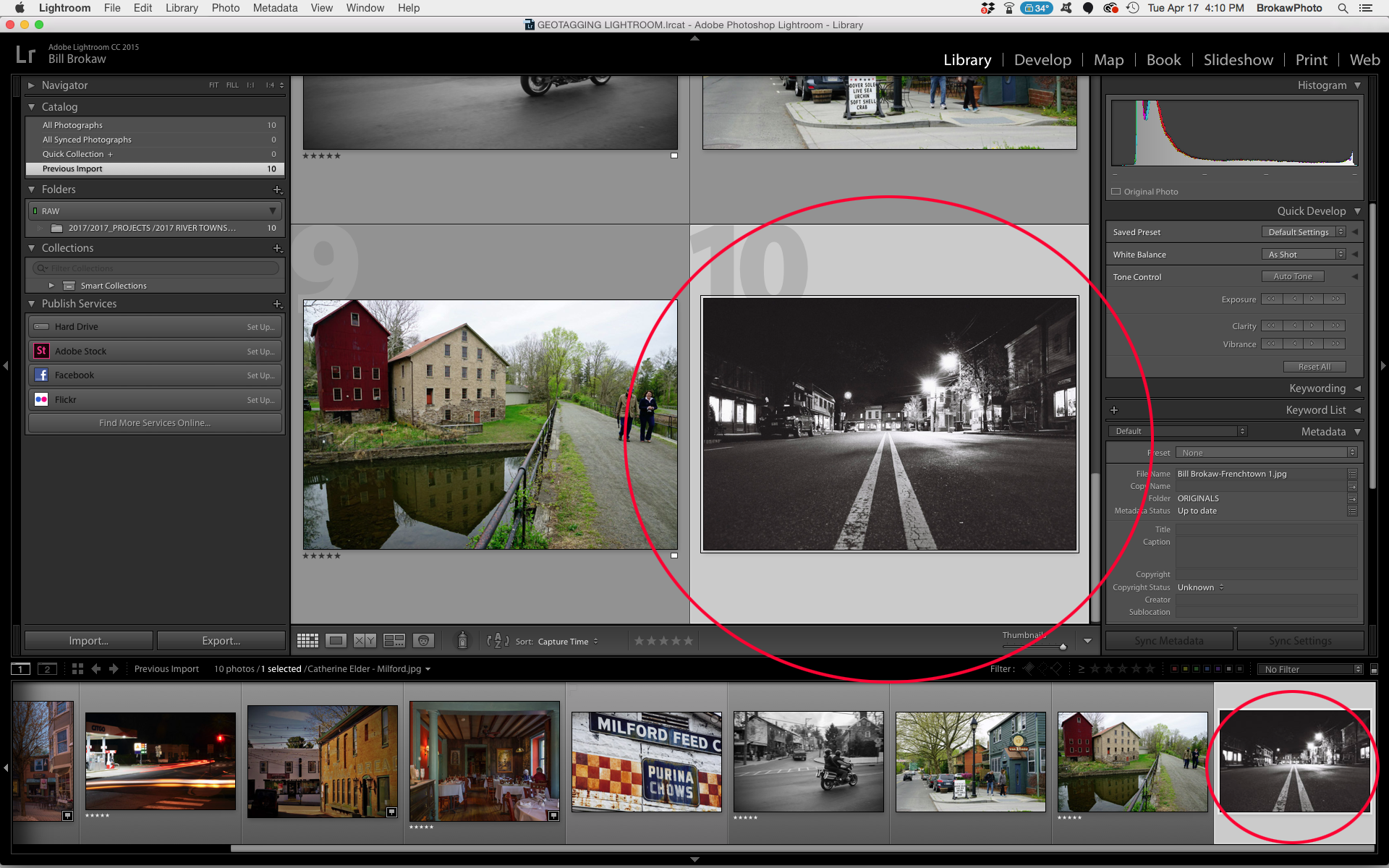
- The first step is to import your photos into Lightroom and select the photo to which you want to add coordinates. The image below shows us in the “Library” module (the word Library is highlighted at the top of the screen) and one of our photos is selected.
–
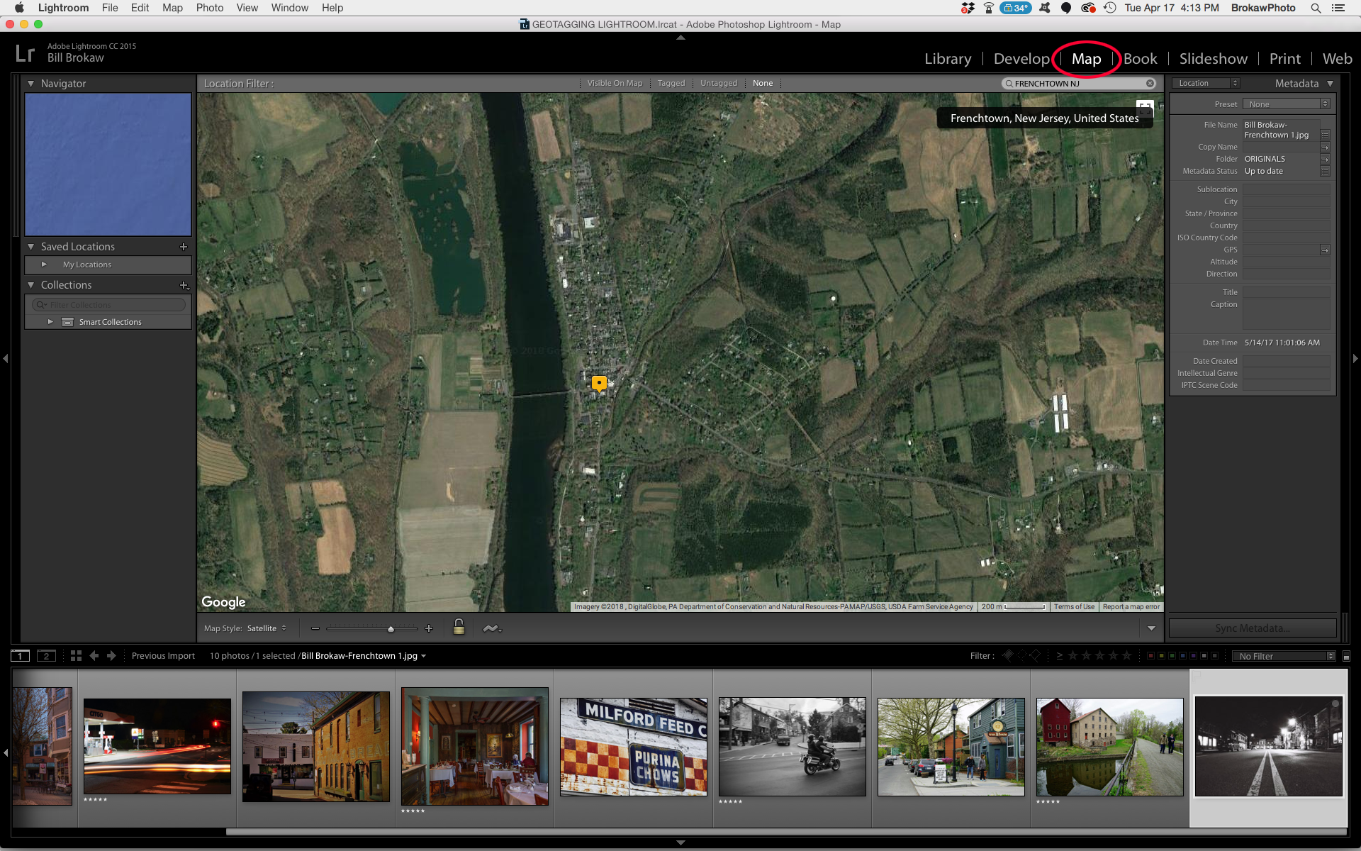
- The next step is to switch over to the “Map” module by clicking on the work Map at the top of the screen. This brings up an aerial photo that you will use to find your photo location. You will want to type in the name of the town in the search window to zoom into the general area.
–
- Next your can zoom in closely to where your photo was taken (be sure that the correct photo is still selected) and then right-click on the aerial at the location of the scene that you photographed. (I added the red dot to show where I right-clicked on the map. A red dot won’t show up in Lightroom, just the message.) The message will ask if you want to add GPS coordinates. To confirm, click on the message. Only one photo can be geotagged at a time.
–
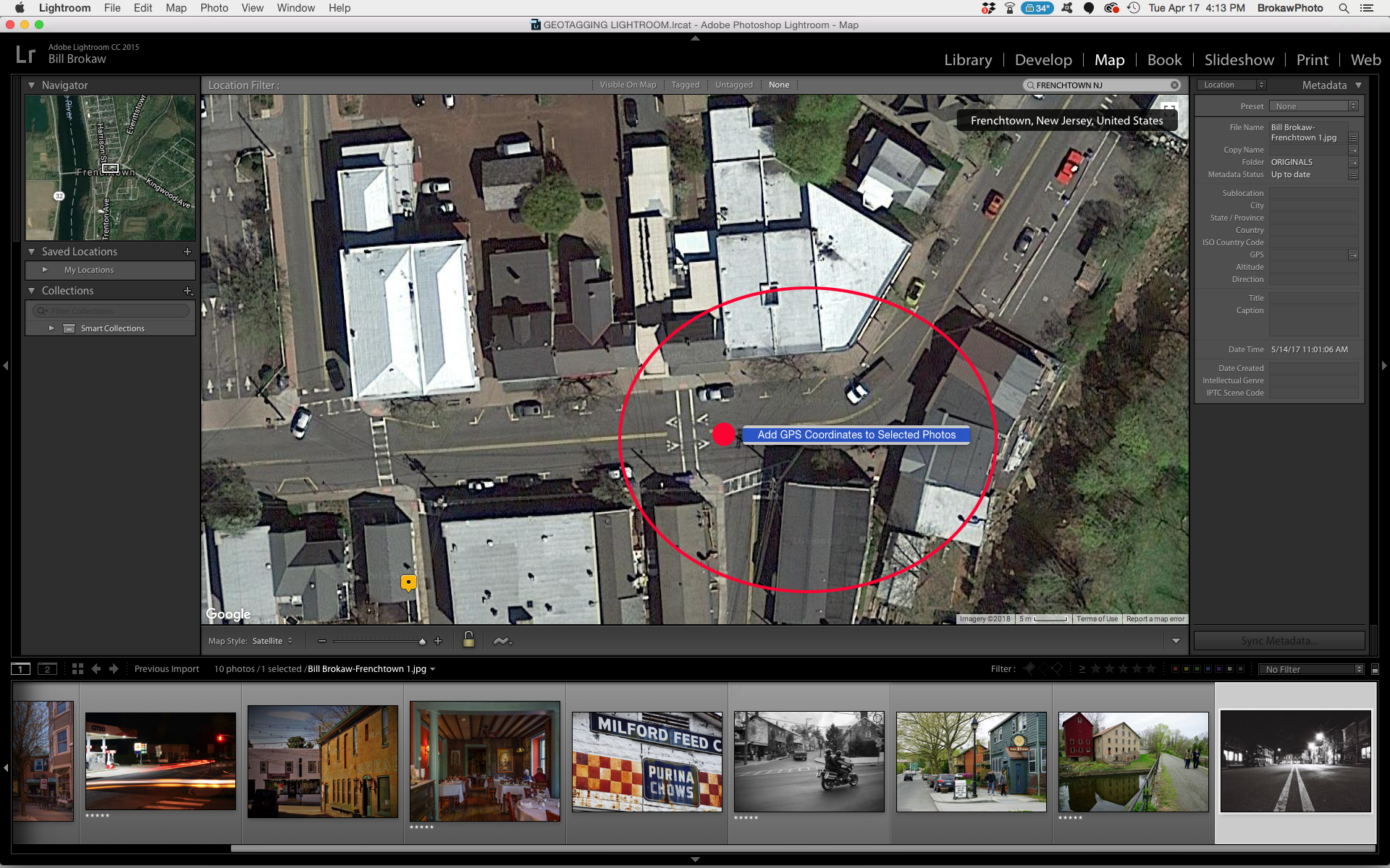
When you’ve geotagged your photo, a yellow icon will appear and the latitude, longitude and altitude of the photo’s location will be attached as shown below. If you think you are a little off, you can simple move the icon to the correct location and the coordinates will be updated.When you unselect the photo this icon will turn red.
If you have a Google account you can create your own custom maps and add photos. This is a great way to record locations where you’ve taken photos.
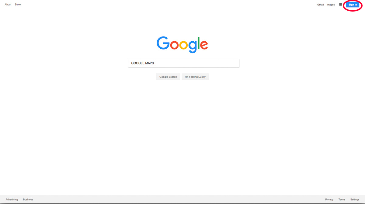
The first step, of course, is to log into my Google account.
I go to Google Maps and search for my location. The photo I am going to add is in Frenchtown.
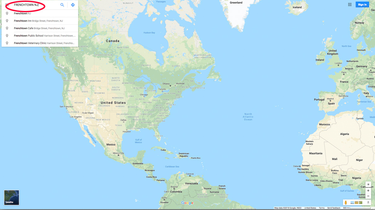
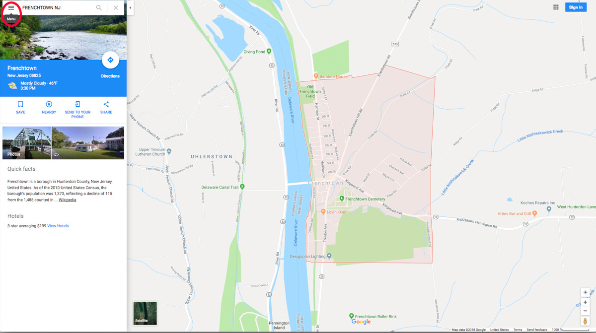
When the map takes me to Frenchown I click the “hamburger” in the upper left corner to display the map menu.
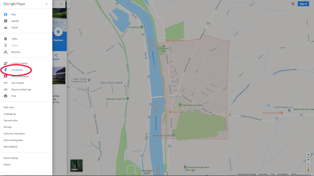
When the menu pops up I click on the little paddle that says “Places.”
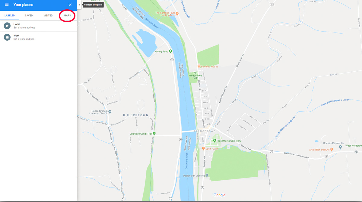
The Places link takes me to another screen where there are four choices at the top of the menu. I want to create a map, so naturally I click on the word “Map.”
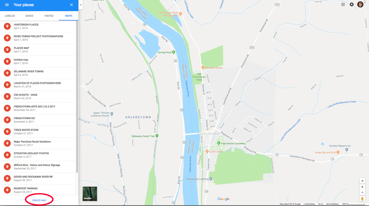
This will bring up maps I’ve created. I have a lot of maps I’ve already made. To create my new map I click on “CREATE MAP” at the bottom of the menu.
Now I need to search again for my location. (To tell the truth I didn’t really need to search for it the first time but it made a good way to start the blog post.)
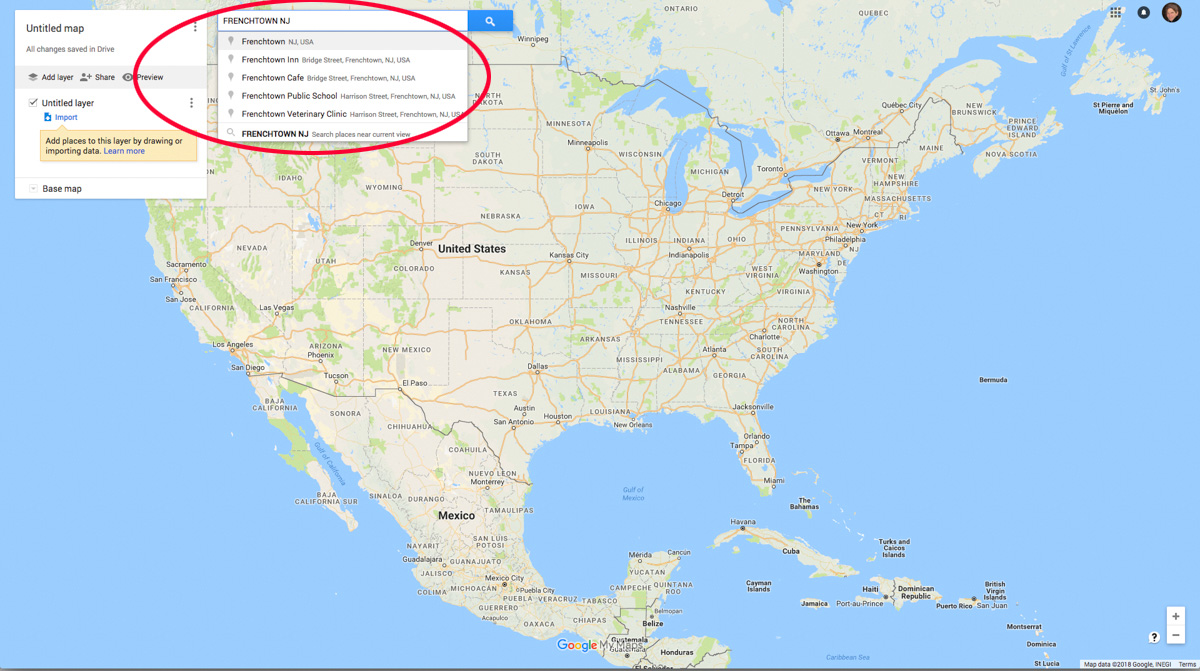
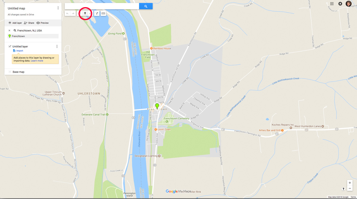
When Google Map displays my location I can start adding points or polygons to it by clicking on one of the icons at the top of the screen. I want to create a point so I click on the little blue paddle icon.
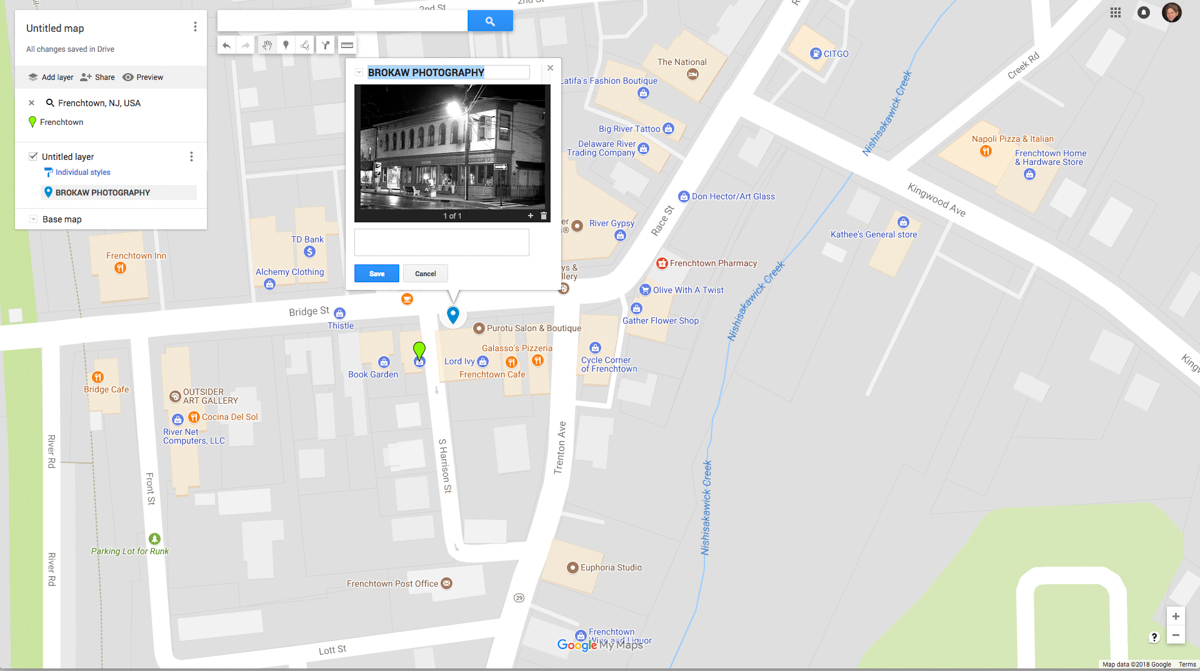
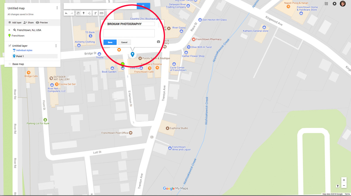
The next step is to click on the location of my photograph. To be precise I need to zoom in and click on the location of my photo. Here I am prompted to name my point.
To add a photo I click on the little camera icon which will prompt me to upload a photo.
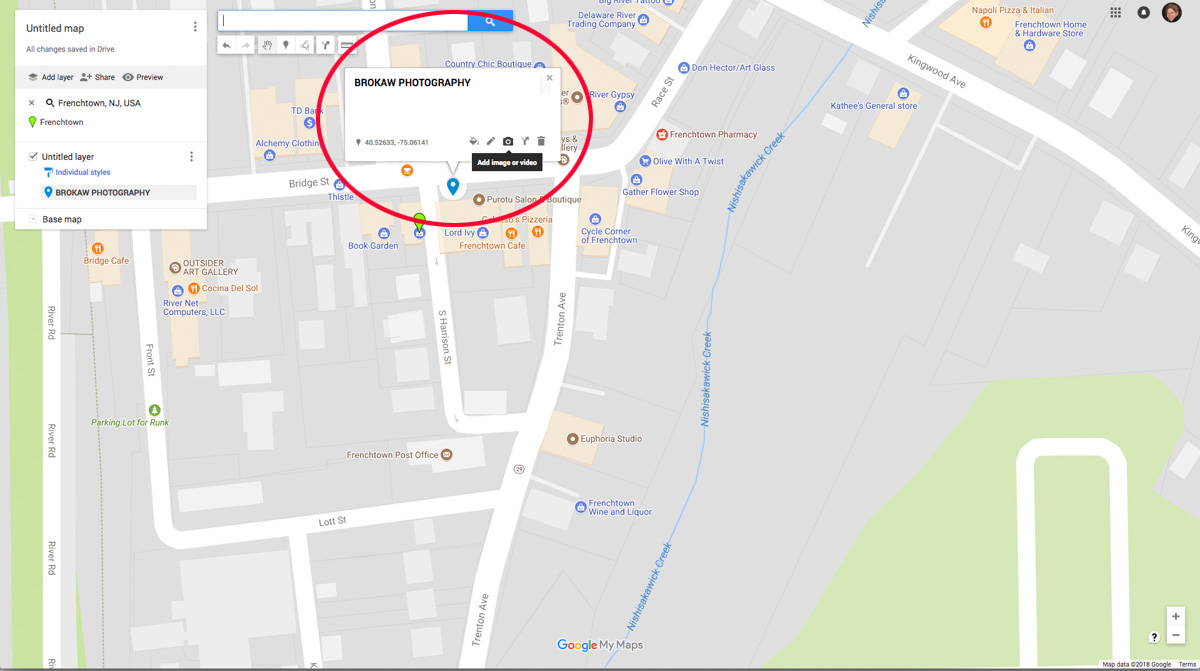
You can add a photo from your computer, Google Drive, your web camera a website or even YouTube. …
They may hear what you are saying, but are they listening? Is it just noise or does it stir something?
We’re pretty good at filtering noise, whether it’s sound or something visual. That’s a good thing. You can’t focus on everything.
It also means we are being filtered out if we are just making noise.
…
Bridget Wingert had a vision to create a local paper in the early 2000’s when other newspapers were starting their slow decline. She made it happen and it’s still happening. The Bucks County Herald, based in Lahaska, PA serves up local news throughout Bucks and Montgomery Counties in PA and is even expanding its reach into neighboring Mercer and Hunterdon Counties in NJ.
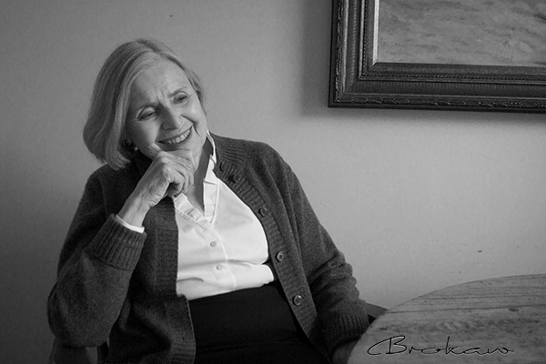
I’ve done my share of photojournalism and watched as papers round the country shed their staff. The business model has changed from using ads to support journalism to just using bits and pieces of news for the purpose of selling online ads. (Don’t you just love pop-ups?) . The Herald hasn’t succumbed. There is a lot happening locally and the Herald’s reporters and photographer do an amazing job of covering everything from local government to sports to business news. I was delighted to be asked to do Bridget’s business portrait. I’m a fan.
 …
…
Hunterdon Places is a photo project open to all photographers: kids and adults, amateurs and pros. It isn’t a contest but rather a big collaborative project among people who love to take photos.
The idea is for everyone to photograph in the same locations during the same time and see what we create together.
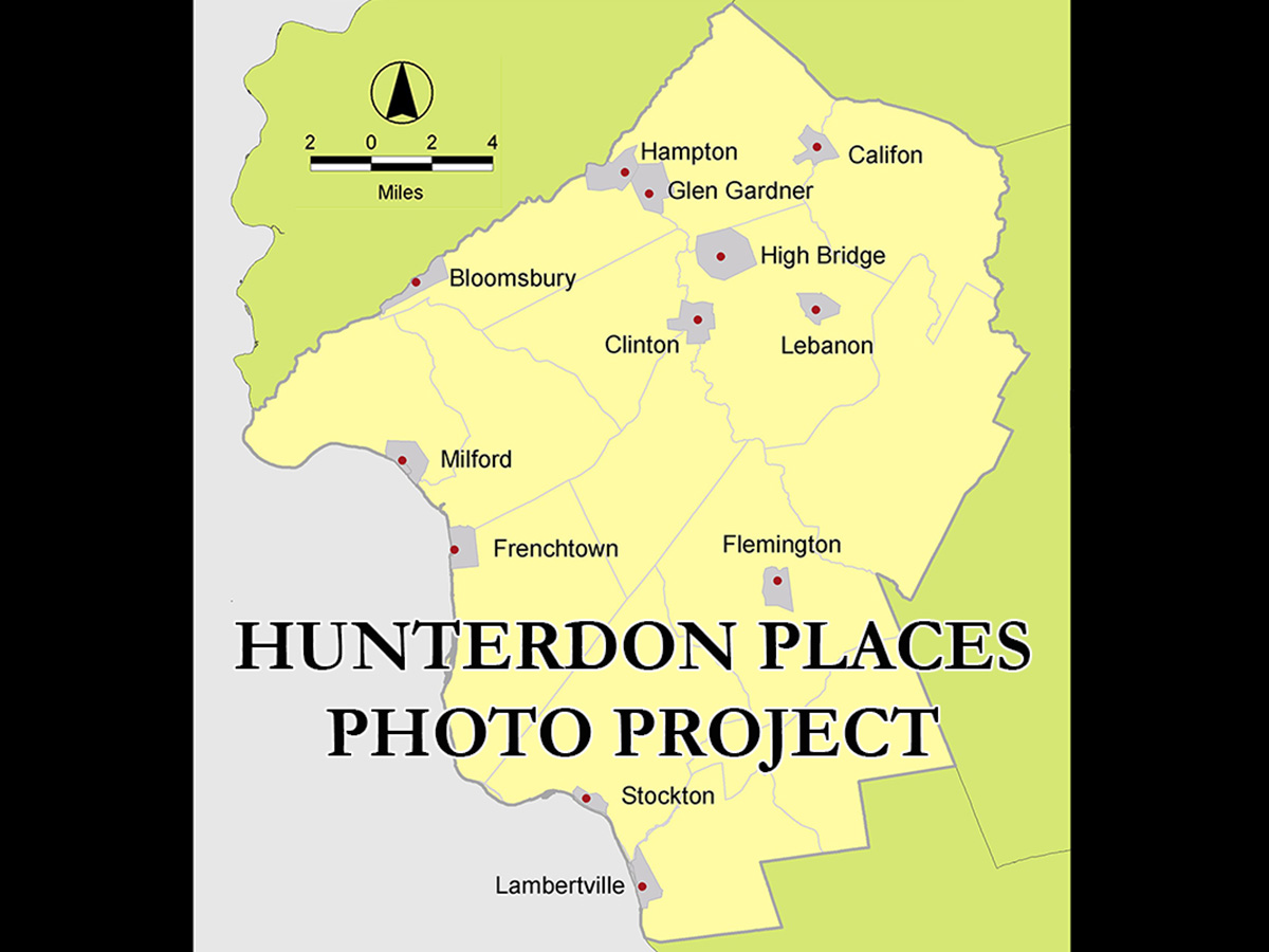
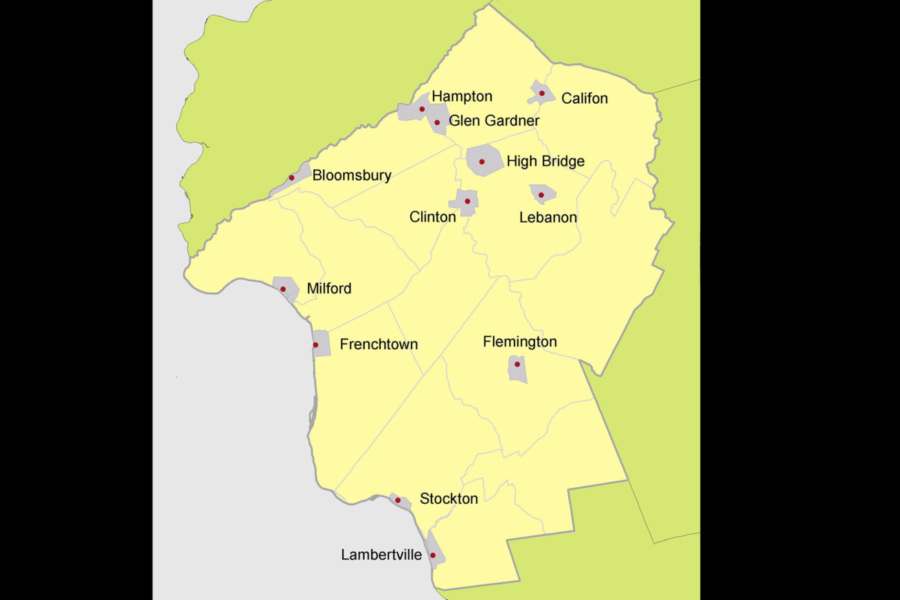
The shoot will take place during Earth Day Weekend, April 21st and 22nd, 2018. The locations are the twelve incorporated municipalities of Hunterdon County, NJ. Below is a live Google Map of the project areas that you can browse.
The project will culminate in two showings, one at Brokaw Photography studio in Frenchtown, NJ and one at the Hunterdon County Community Day event at the County Fairgrounds in Ringoes.
This project is all about exploring, experiencing and enjoying.
…
I figure we are all thriving in one way or another. It’s mostly a matter of degree and where we are looking.…

