Geotagging is fairly easy and is required in order to embed a photo on Google Earth. Geotagging is the process of adding latitude/longitude coordinates to the metadata of a photo.
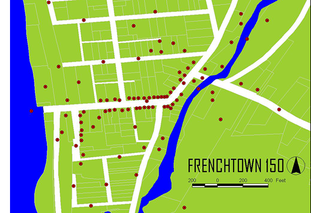
Some cameras will geotag automatically when you take a photo. However, this is the location of the camera when the photo was taken, not the the location being photographed. For our project, FRENCHTOWN 150, we are adding custom coordinates to our digital files. This can be done a number of ways including Lightroom (see my post PROCESSING AND GEOTAGGING FOR FRENCHTOWN 150 IN LIGHTROOM).
You can also geotag online.
Before uploading your photo to geotag it you need to:
CROP YOUR PHOTO SQUARE
RESIZE IT TO 1200×1200 pixels
LABEL “LOCATION – PHOTOGRAPHER.”
NAME IT “LOCATION – PHOTOGRAPHER.jpg”
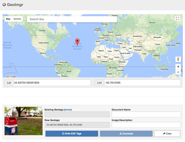
When your photo is properly cropped, sized, labelled and named, upload it to geoimgr.com to geotag it.
The site is fairly intuitive. Here is a short video of the steps.
…